geosimulation :: innovative geospatial simulation and analysis but innovative people

Home | Book | Research | Publications | Bio | Press | Geosimulation Labs
Dr. Paul M. Torrens, Center for Urban Science + Progress, New York University

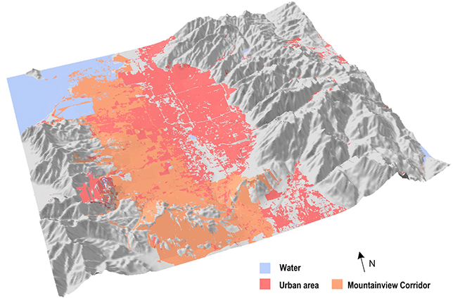
Land cover indicators for U.S. National Climate Assessments

Project overview | Related groups
Project overview

This work, partnering with the Joint Global Change Research Institute is aimed at developing new indicators for the National Climate Assessment. Our role in the project is to develop new spatial analysis routines that can be used to extract geographical signatures from remotely-sensed imagery of the land cover surface.

 
spatial analysis indicators for the national climate assessment
Related groups
Joint Global Change Research Institute


GIS movement tracks

Big data movement analytics


climate indicators spatial analysis

Land indicators of climate

geosimulation high performance computing

High-performance computing and networking for geosimulation

earthquake model agent based GIS

Earthquake models

CA ice sheet model

Ice-sheet modeling


kinect control of GIS and robots
Robot motion control


simulating disasters ABM GIS
Human behavior in critical scenarios


crowd model riot model simulation wired

Modeling riots


physics engine GIS

Dynamic physics for built infrastructure


moving agents through space and time

Moving agents through space and time


validating agent based models

Validating agent-based models


machine learning GIS

Machine-learning behavioral geography


high performance computing urban simulation emergence

Accelerating agent-based models


megacity models

Megacity futures


immersive modeling

Immersive modeling


space-time GIS

Space-time GIS and analysis


measuring sprawl

A toolkit for measuring sprawl


space-time GIS

Modeling time, space, and behavior


simulating crowd behavior

Simulating crowd behavior


wi-fi geography

Wi-Fi geography


Simulating sprawl

Simulating sprawl